| PalestineRemembered | About Us | Oral History | العربية | |
| Pictures | Zionist FAQs | Haavara | Maps | |
| Search |
| Camps |
| Districts |
| Acre |
| Baysan |
| Beersheba |
| Bethlehem |
| Gaza |
| Haifa |
| Hebron |
| Jaffa |
| Jericho |
| Jerusalem |
| Jinin |
| Nablus |
| Nazareth |
| Ramallah |
| al-Ramla |
| Safad |
| Tiberias |
| Tulkarm |
| Donate |
| Contact |
| Profile |
| Videos |
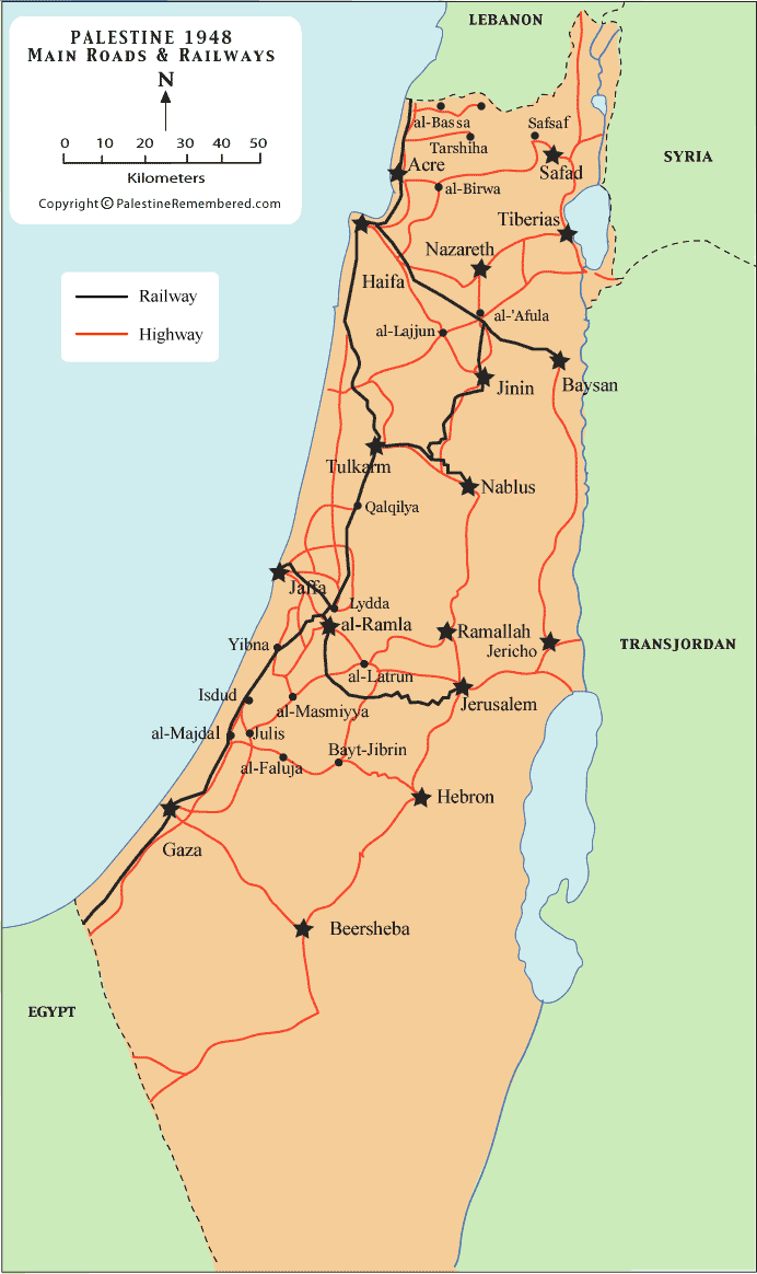
Palestine Maps: Main Roads And Railways Before Nakba |


Post Your Comment
*It should be NOTED that your email address won't be shared, and all communications between members will be routed via the website's mail server.
عند تفحص خطوط السكة الحديد في فلسطين - الحبيبة - في الخريطة أعلاه فيما مضى من الزمان نلاحظ عدم وصول الخط لمدينة بير السبع
الا انني رأيت صورة لمبنى محطة سكة حديد في مدينة بير السبع , هذا قبل الاحتلال الصهيوني .
هذا للاحاطة ,, مع تقديري وشكري على مجهوداتكم ,
الدكتور زكريا نصار