| PalestineRemembered | About Us | Oral History | العربية | |
| Pictures | Zionist FAQs | Haavara | Maps | |
| Search |
| Camps |
| Districts |
| Acre |
| Baysan |
| Beersheba |
| Bethlehem |
| Gaza |
| Haifa |
| Hebron |
| Jaffa |
| Jericho |
| Jerusalem |
| Jinin |
| Nablus |
| Nazareth |
| Ramallah |
| al-Ramla |
| Safad |
| Tiberias |
| Tulkarm |
| Donate |
| Contact |
| Profile |
| Videos |
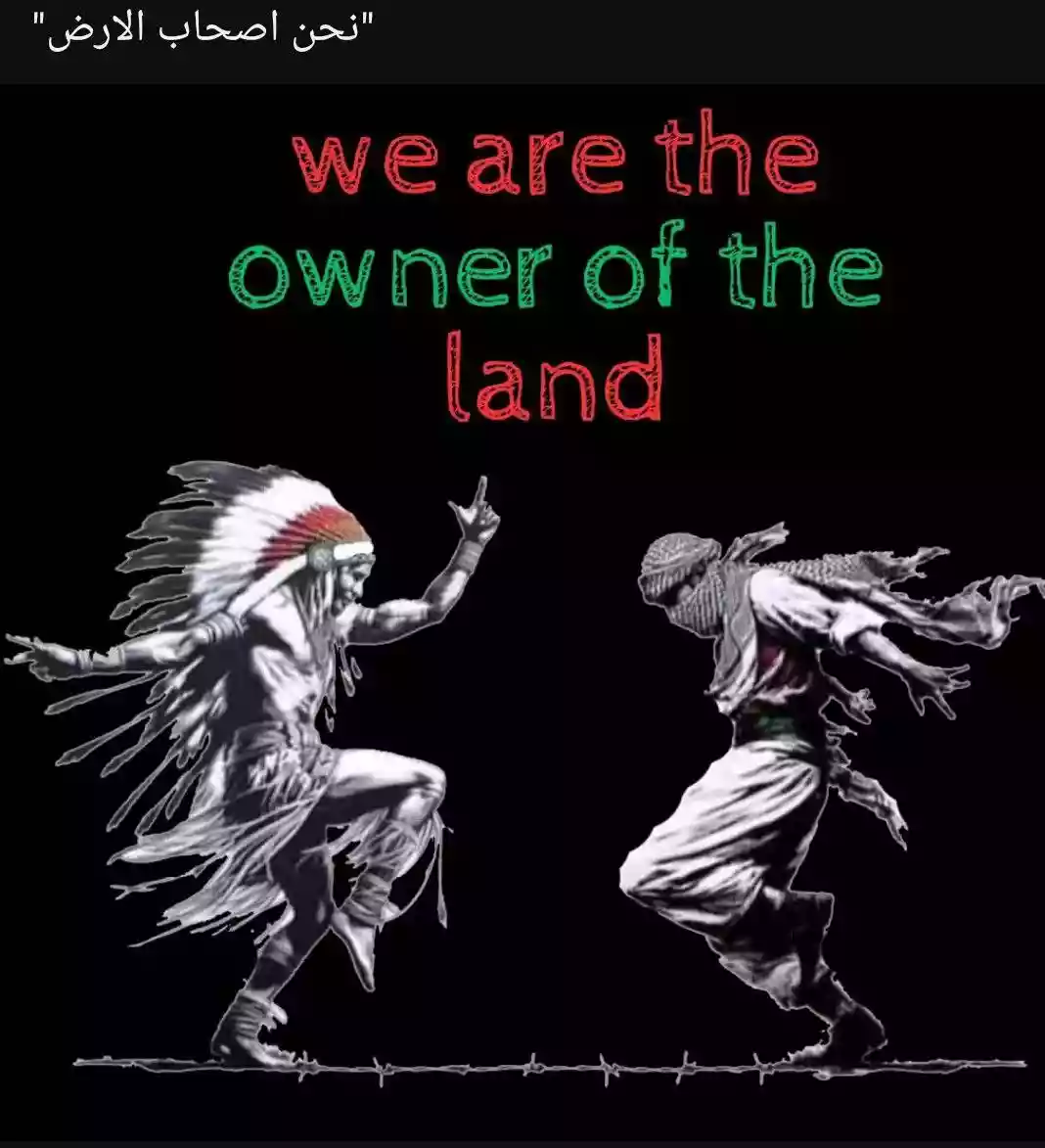
Welcome To 'Arab al-Samniyya - عرب السمنيه (ערב א-סמניה)
|
District of Acre
Ethnically cleansed days ago |
العربية Google Earth |
 |
Gallery (35) |
- Statistics & Facts
-
Before & After

- Satellite View
- Articles 11
- Pictures 35
- Oral History 1
- Members 2
- Families
- All That Remains
- Wikipedia
- Videos 1
- Guest Book 2
- Links
| Statistic & Fact | Value | ||||||||||
| Occupation Date | October 30, 1948 | ||||||||||
| Distance From District | 19.5 (km) Northeast of Acre | ||||||||||
| Elevation | 150 (meters) | ||||||||||
| Before & After Nakba, Click Map For Details |
|||||||||||
|
|||||||||||
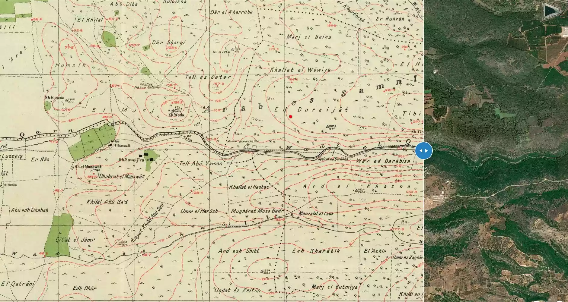
| Map Location | See location #8 on the map View from satellite |
||||||||||
| Military Operation | Operation Hiram | ||||||||||
| Attacking Units | 'Arab al-Samniyya was attacked by units drawn from four different Israeli brigades (Sheva', Carmeli, Golani, and 'Oded). | ||||||||||
| Acts of Terror | Massacre occured by Zionist troops against the town's inhabitants. | ||||||||||
| Exodus Cause | Military assault by Zionist troops | ||||||||||
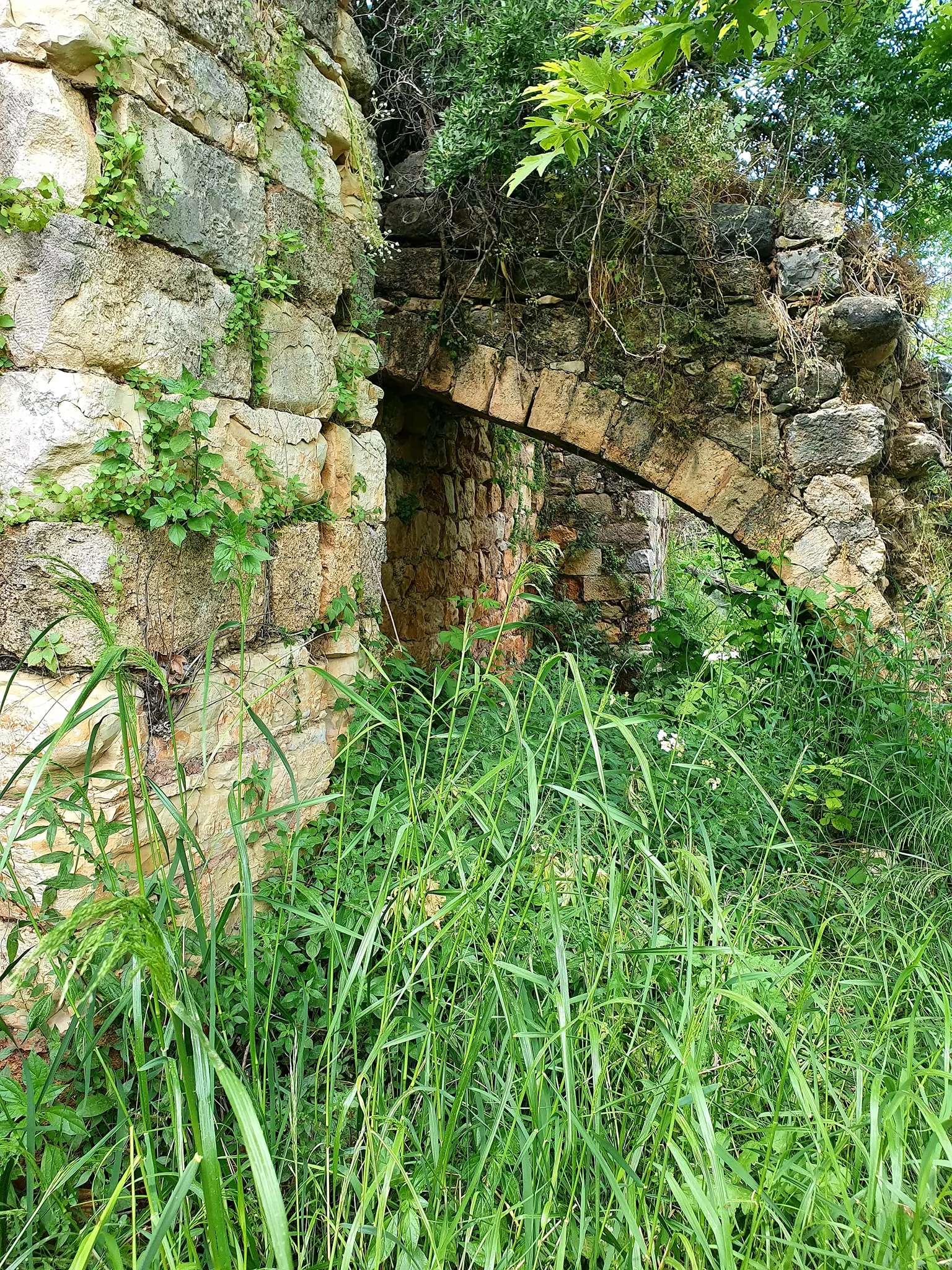
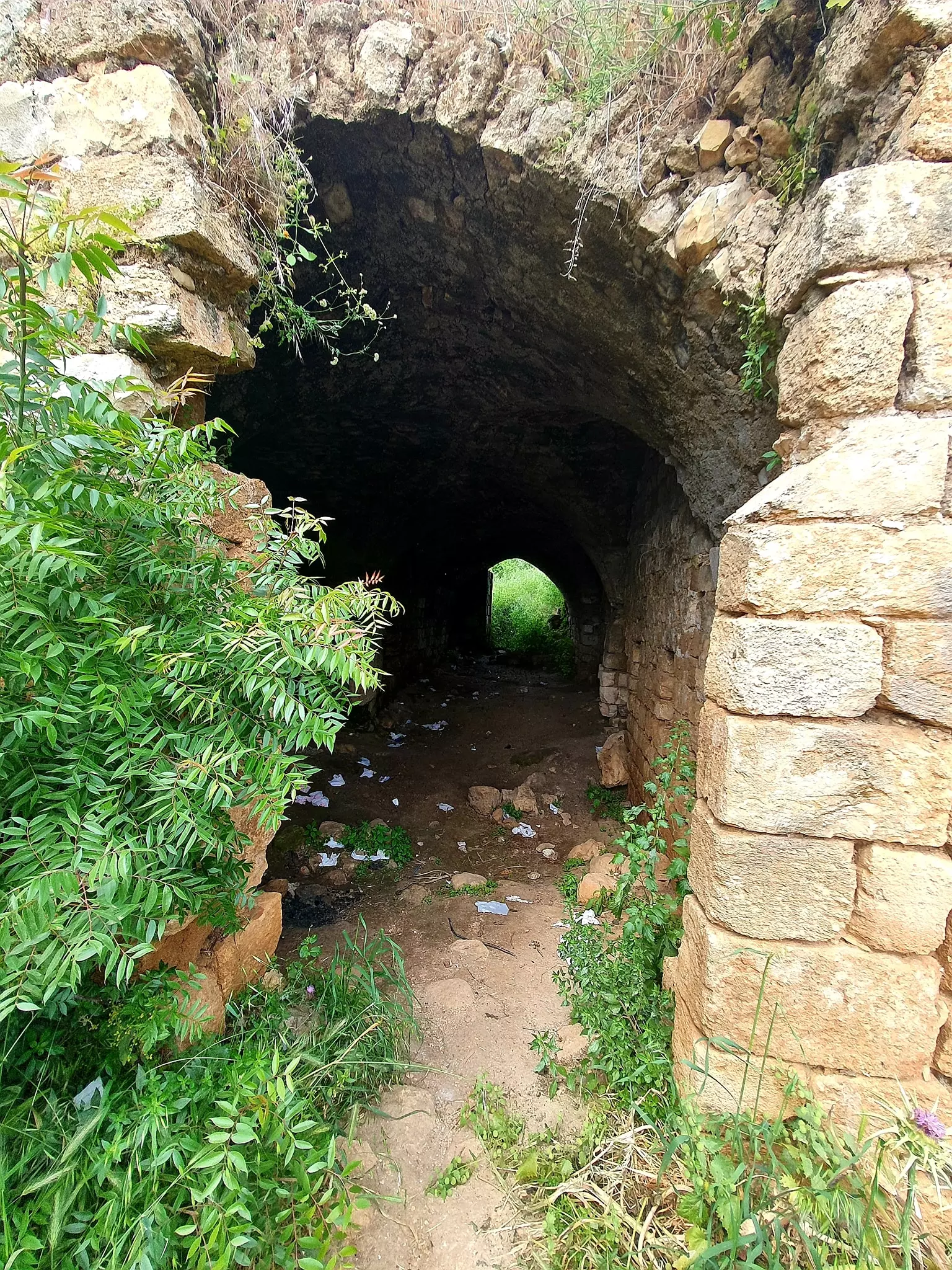
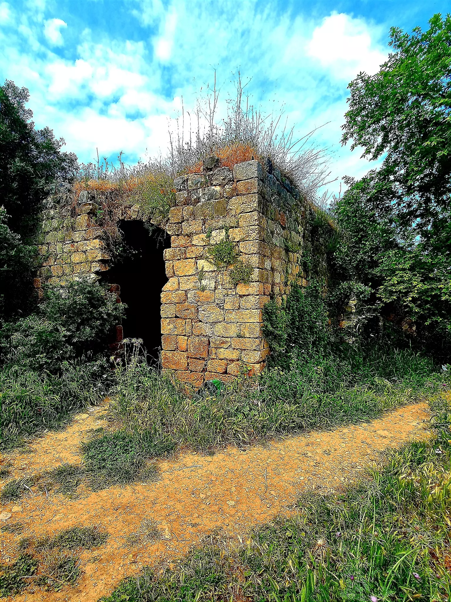
| Village Temains | The village was completely destroyed, and only house rubble left behind. | ||||||||||
| Ethnically Cleansing | 'Arab al-Samniyya inhabitants were completely ethnically cleansed. | ||||||||||
| Pre-Nakba Land Ownership |
|
||||||||||
| Land Usage As of 1945 |
|
||||||||||
| Population |
|
||||||||||
| Exculsive Jewish Colonies Who Usurped Village Lands |
Ya'ara | ||||||||||
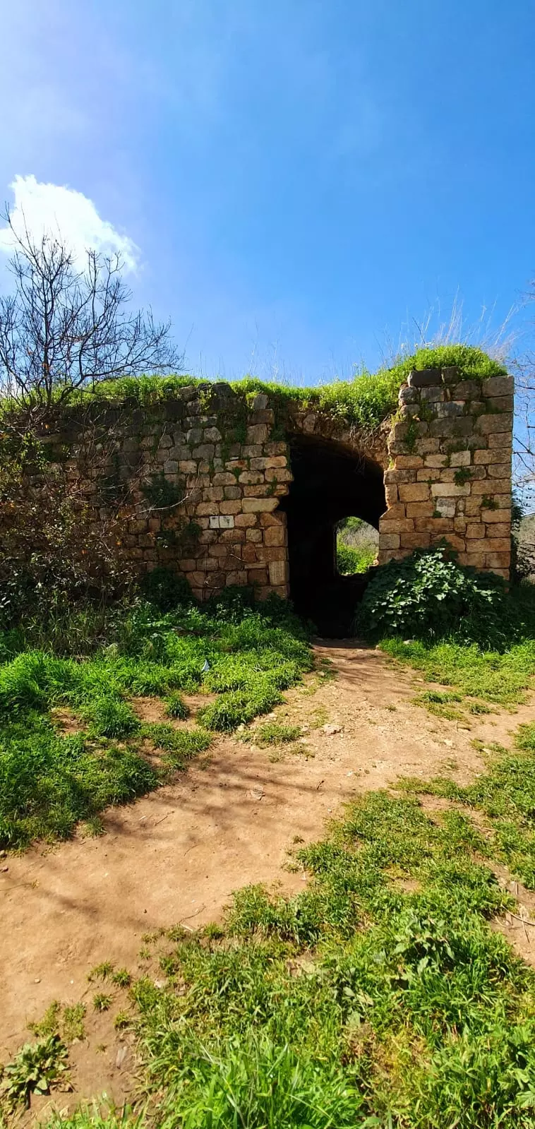
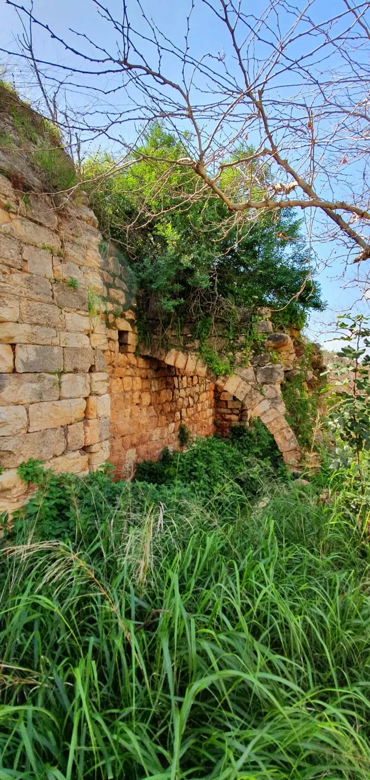
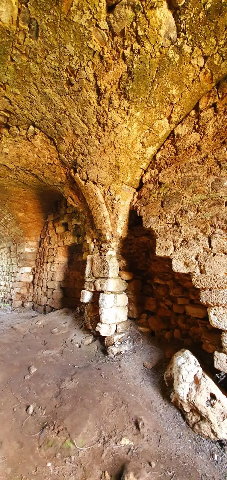
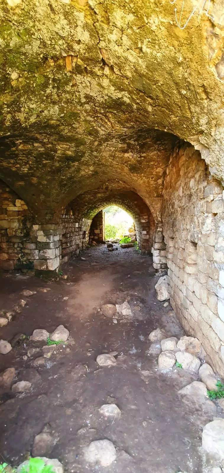
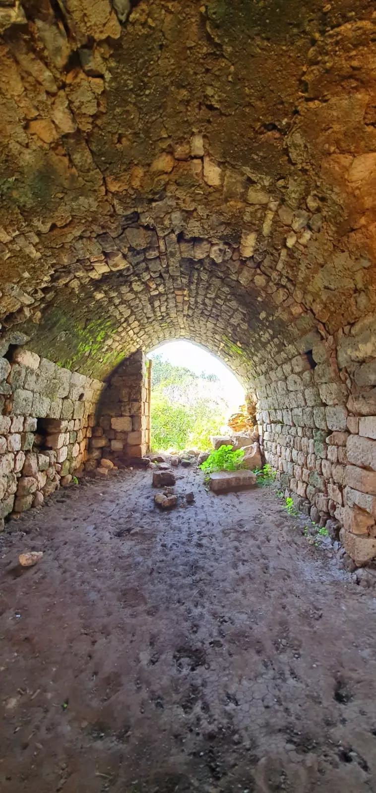
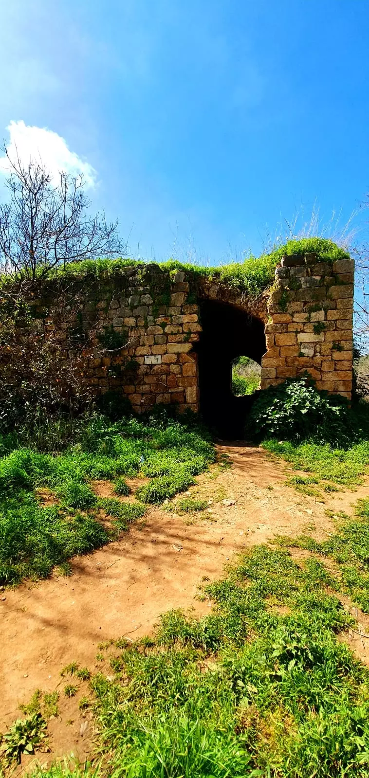
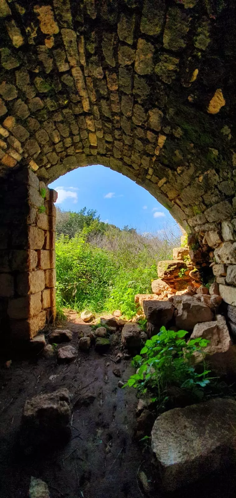
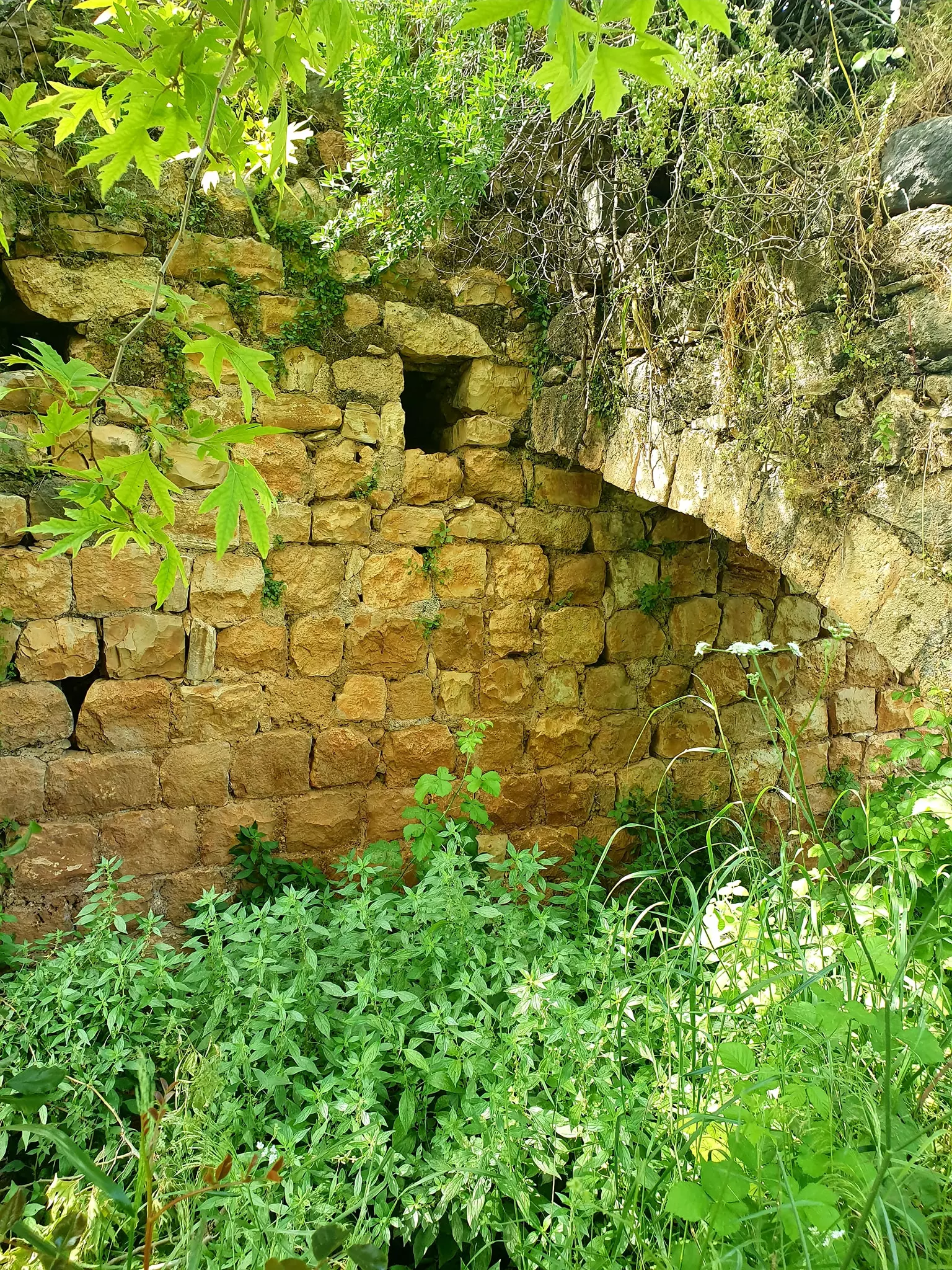
Village Before NakbaThe village, which was also known as Khirbat al-Suwwana, was situated on a rocky hill near the road linking Ra's al-Naqura with Safad. Its houses were made of stone. A dirt path linked it to the coastal highway and hence to Acre. The villagers cultivated grain, figs, and olives. In 1944/45 a total of 174 dunums was allocated to cereals; 22 dunums were irrigated and used for orchards.Village Occupation and Ethnic CleaningArab al-Samniyya was probably taken at the end of Operation Hiram, on 30-31 October 1948. The village would have been reached shortly after Tarbikha and Iqrit, and like these two nearby villages, might not have been emptied directly. Judging from circumstantial evidence cited by Israeli historian Benny Morris, its people may have been expelled in the coming weeks, under the guise of creating a 'secure' border.Zionists Colonies on Village LandsThe settlement of Ya'ara was established in 1950 on village land.Village TodayOnly the stone rubble of houses, crumbling walls, and a few roofs remain of the village buildings. The terraces of fig and olive groves are still visible.SourceDr. Walid al-Khalidi, 1992: All That Remains. |
|||||||||||
| Related Maps | Town Lands' Demarcation Maps خرائط للقضاء توضح حدود القرى والاودية Town's map on MapQuest View from satellite Help us map this town at WikiMapia |
||||||||||
| Related Links | Wikipedia's Page Google Search Google For Images Google For Videos |
||||||||||
| More Information | في كتاب كي لا ننسى المزيد من موقع هوية |
||||||||||
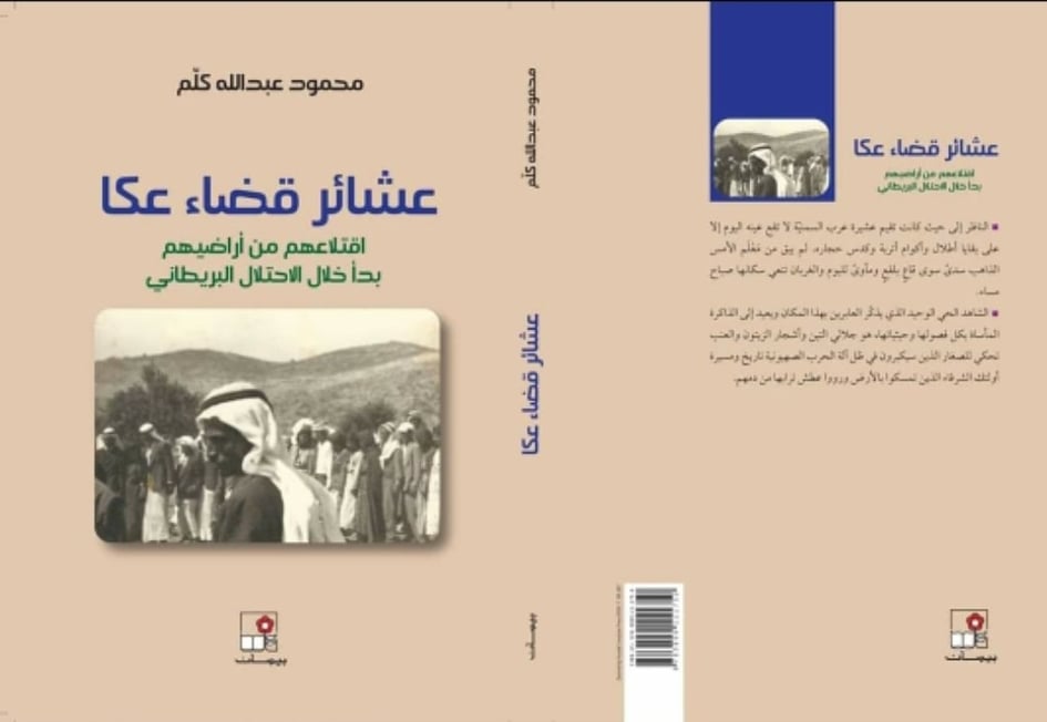
- عشائر قضاء عكا - اقتلاعهم من اراضيهم بدأ خلال الاحتلال البريطاني , محمود كلّم - كاتب وباحث فلسطيني
- من التراث الشعبي البدوي.. ثقافة القهوة التي نشربهـا..مجلة العودة -لندن-عدد ايلول ٢٠١٠
- نبذة تاريخية عن قرية عرب السمنيه (قضاء عكا) من كتاب (كي لا ننسى)
- عشيرة عرب السمنيّة --- محمود كلّم - كاتب وباحث فلسطيني
- مجزرة عرب السمنيّة --- محمود كلّم - كاتب وباحث فلسطيني
- المُغتصبات الصُّهيونيَّة على أراضي عشيرة عرب السَّمنيّة -محمود كلّم - كاتب وباحث فلسطيني
- الأوديةُ والينابيعُ في أرضِ عشيرةِ عربِ السَّمنيّة -- محمود كلّم - كاتب وباحث فلسطيني
- عبد الله كلّم: خيط الدّم، الأفق المُدمّى / محمود كلّم - كاتب وباحث فلسطيني
- عشيرة عرب السّمنيّة بين الاقتلاع والتشبث بالأرض.-- محمود كلّم - كاتب وباحث فلسطيني
- مواقعُ مهمَّةٌ في أرضِ عشيرةِ عربِ السّمنيّة -- محمود كلّم - كاتب وباحث فلسطيني
- حين تغفو العين وتظل بانتظار الحلم !! محمود كلّم - كاتب وباحث فلسطيني
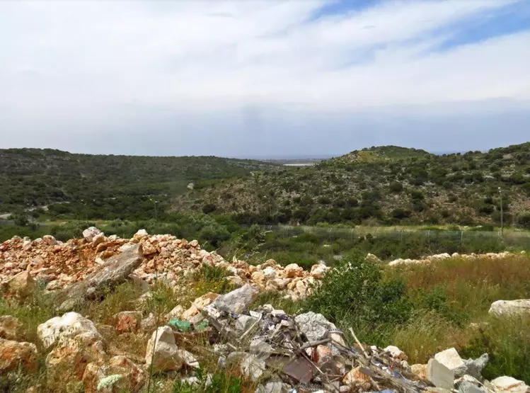
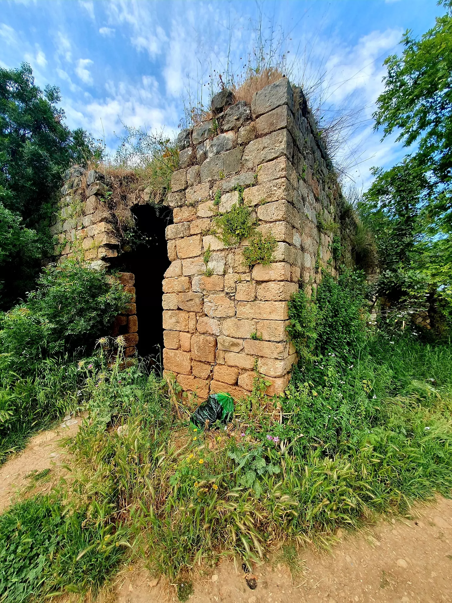
- House rubble at 'Arab al-Samniyya
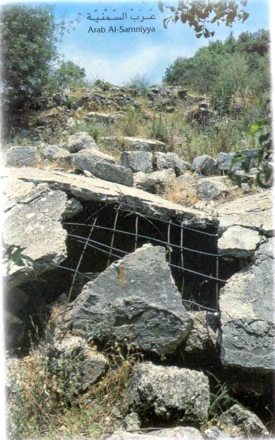
3 - اثار ردم بيوت القريه
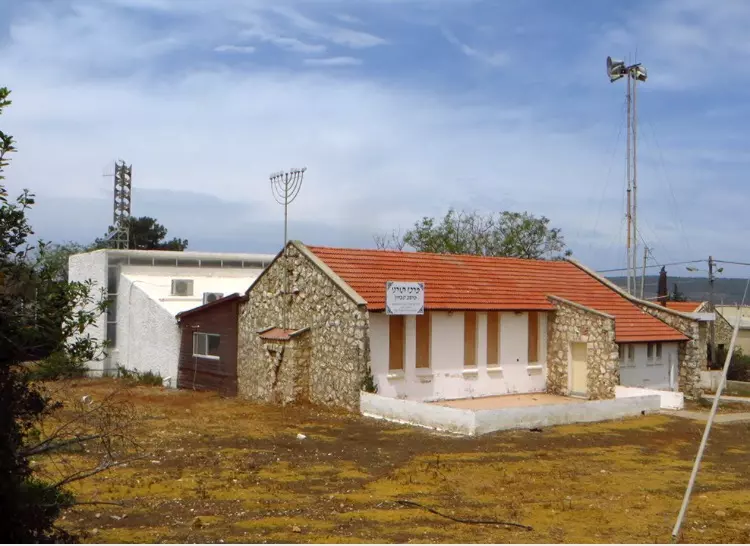
Posted by abu raya - بيت من القريه حوله المستوطنين الى كنيس
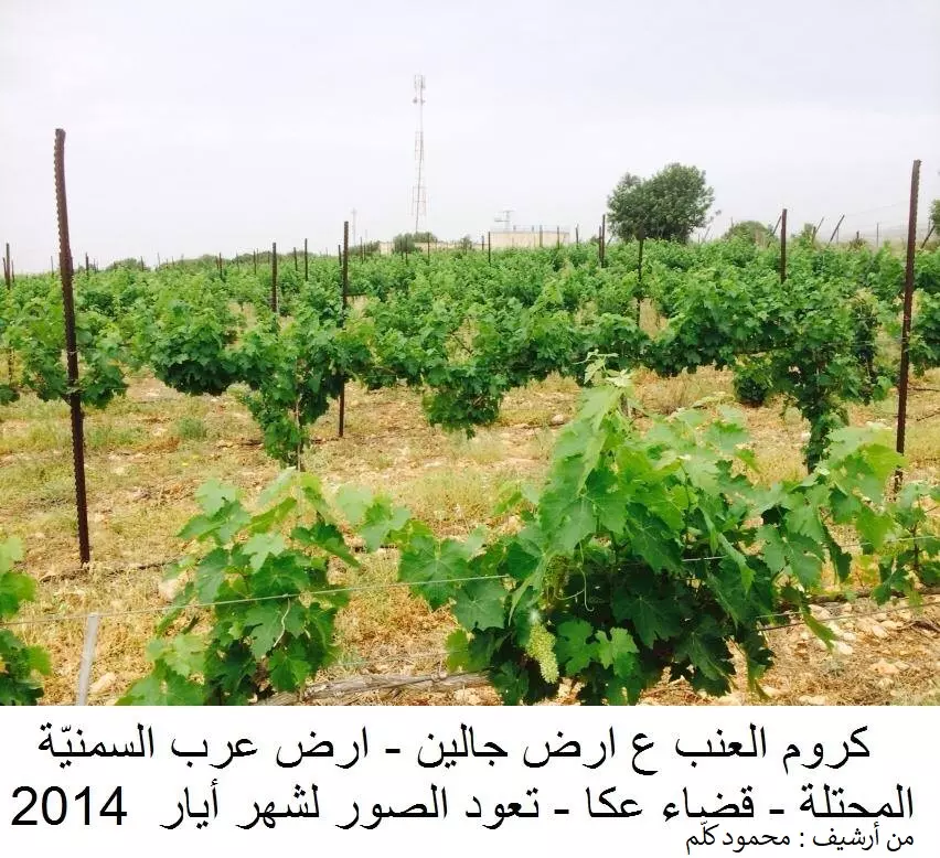
Posted by abu raya - كروم العنب ع أرض جالين أرض عشيرة عرب السمنيّة- قضاء عكا ، تعود الصورة لشهر أيار ٢٠١٤ ( من أرشيف : محمود كلّم )
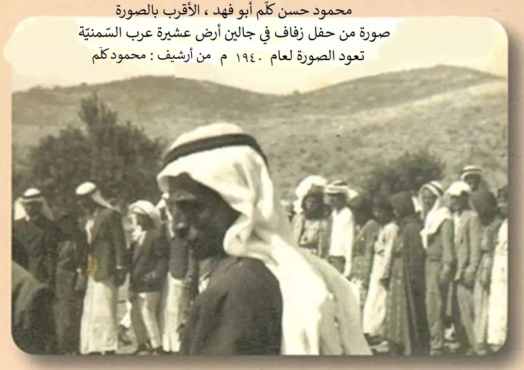
Posted by mahmoud kallam - عرب السمنيه : محمود حسن كلّم أبو فهد ، الأقرب بالصورة . صورة من حفل زفاف في جالين أرض عشيرة عرب السمنيّة ، تعود الصورة لعام ١٩٤٠م.
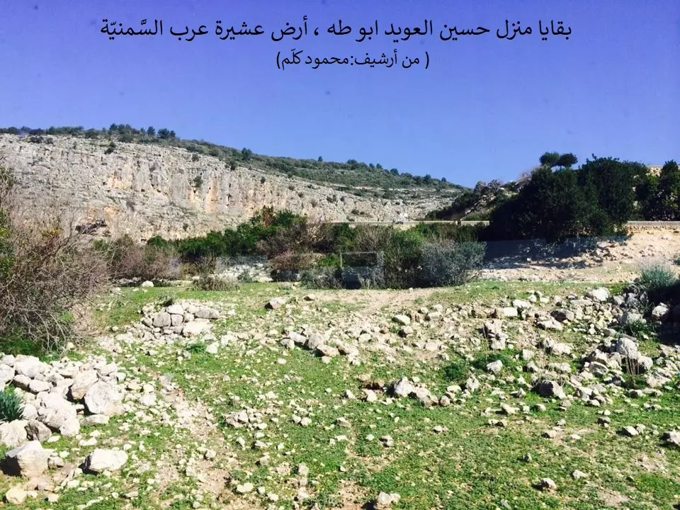
Posted by mahmoud kallam - بقايا منزل حسين العويد أبو طه ، أرض عشيرة عرب السمنيّة (من أرشيف:محمود كلّم )
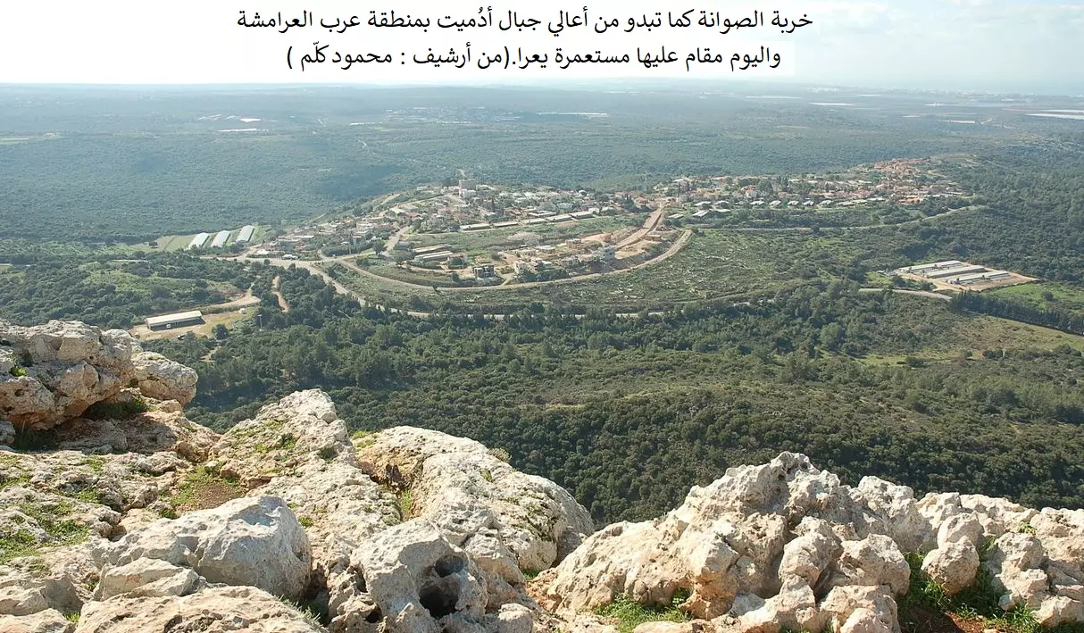
Posted by mahmoud kallam - خربة الصوانة كما تبدو من أعالي جبال أدميت بمنطقة عرب العرامشة واليوم مقام عليها مستعمرة يعرا . (من أرشيف:محمود كلّم )
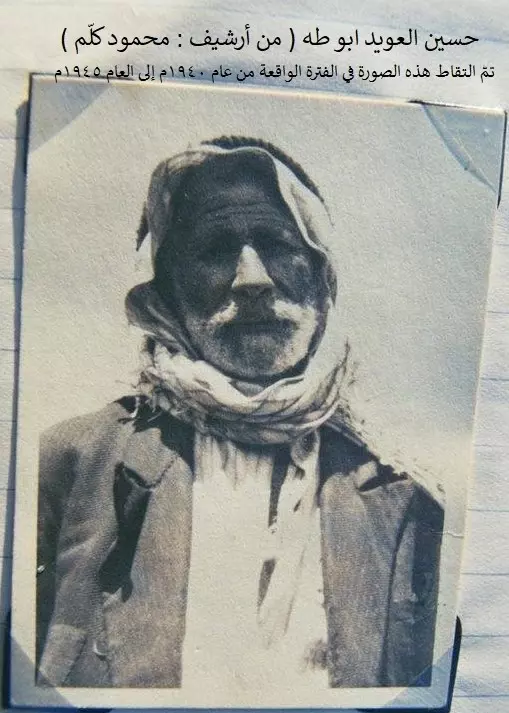
Posted by mahmoud kallam - حسين العويد ابو طه ( من أرشيف : محمود كلّم ) تمّ التقاط هذه الصورة في الفترة الواقعة من عام ١٩٤٠م إلى العام ١٩٤٥م
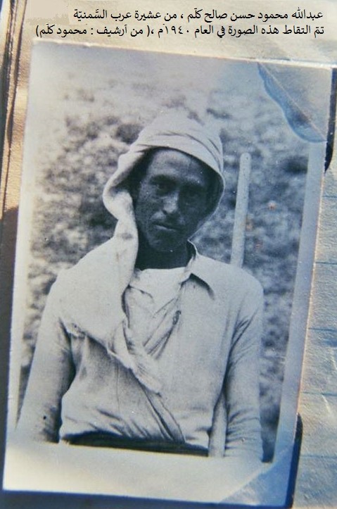
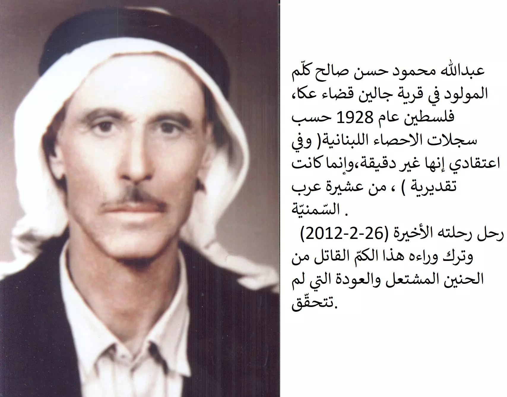
Posted by mahmoud kallam - عبدالله محمود حسن صالح كلّم ، من عشيرة عرب السَّمنيّة تمّ التقاط هذه الصورة في العام ١٩٤٠م ،( من أرشيف : محمود كلّم)
Posted by mahmoud kallam - كتاب: عشائر قضاء عكا: اقتلاعهم من أراضيهم بدأ خلال الاحتلال البريطاني، محمود عبد الله كلَّم، دار بيسان للنشر والتوزيع، بيروت، شباط 2016
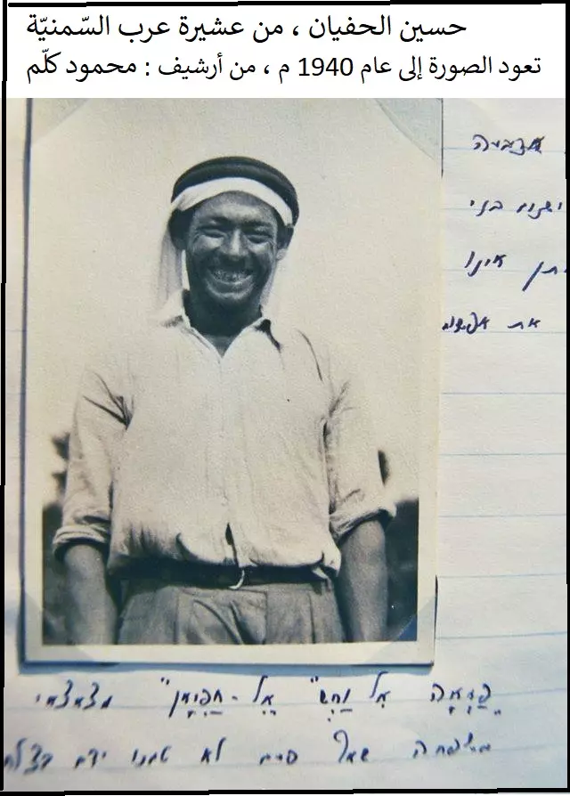
Posted by mahmoud kallam - حسين الحفيان ، من عشيرة عرب السّمنيّة
تعود الصورة إلى عام 1940 م ، من أرشيف: محمود كلّم
Posted by mahmoud kallam - عبدالله محمود كلّم
توفى 26-2-2012
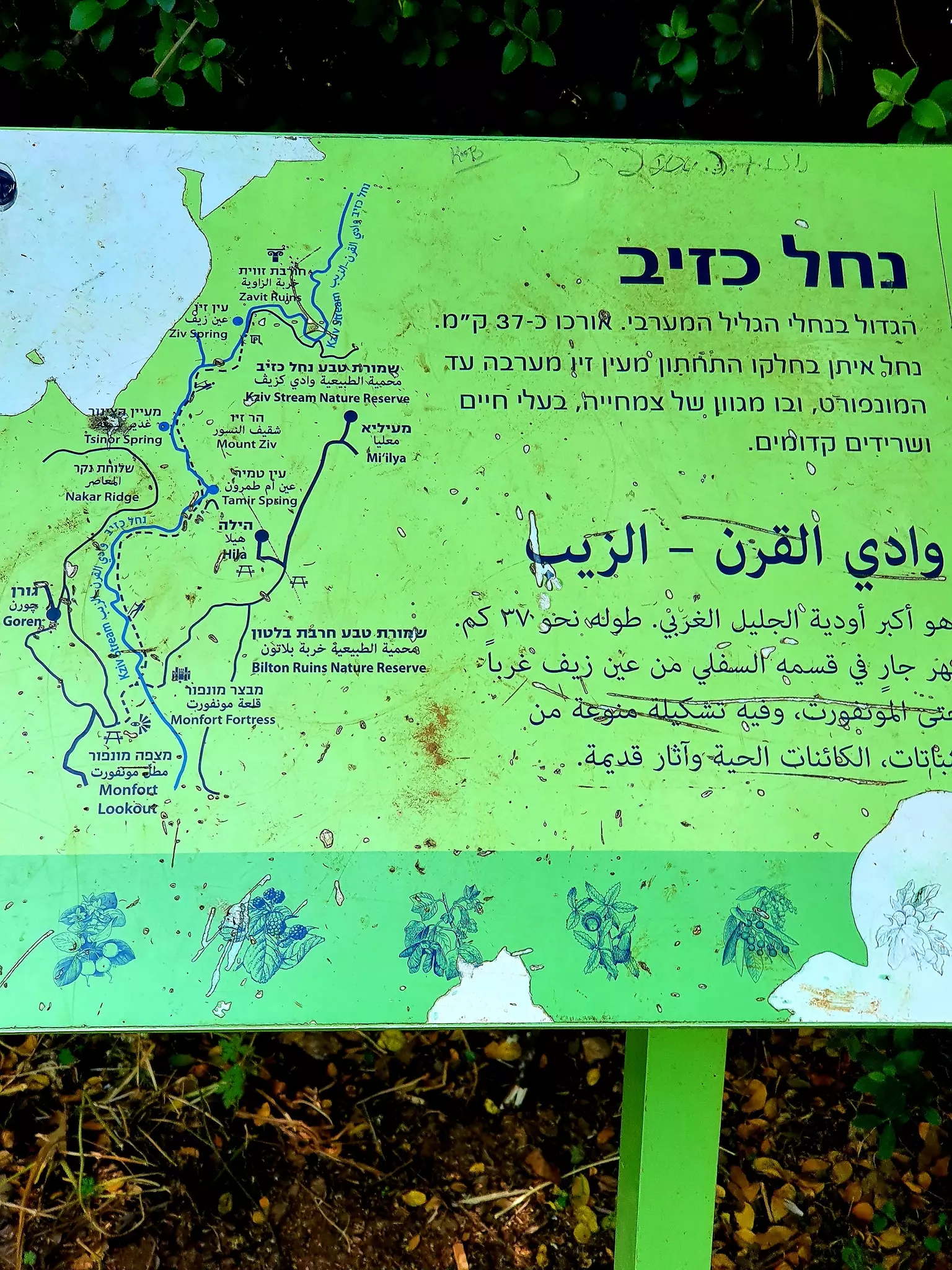
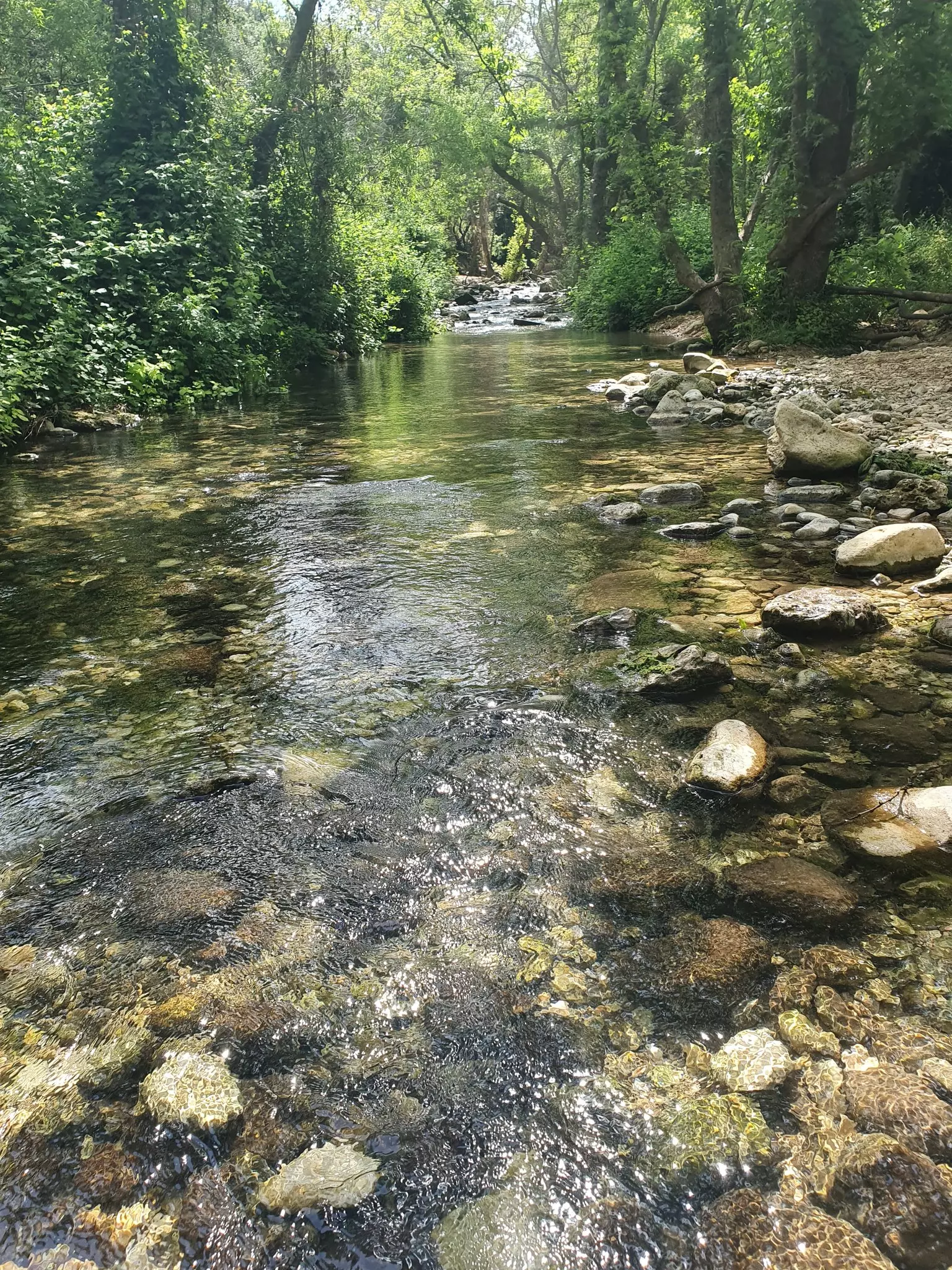
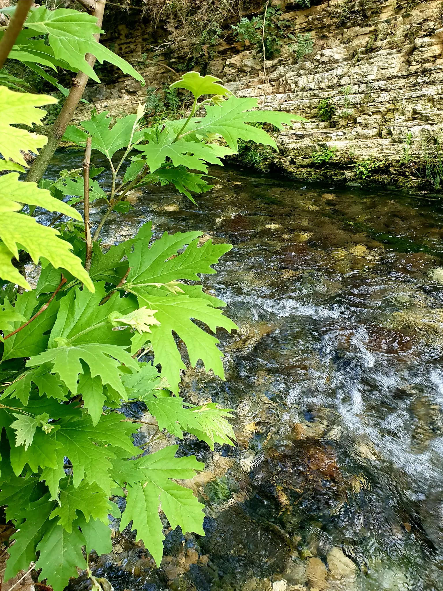
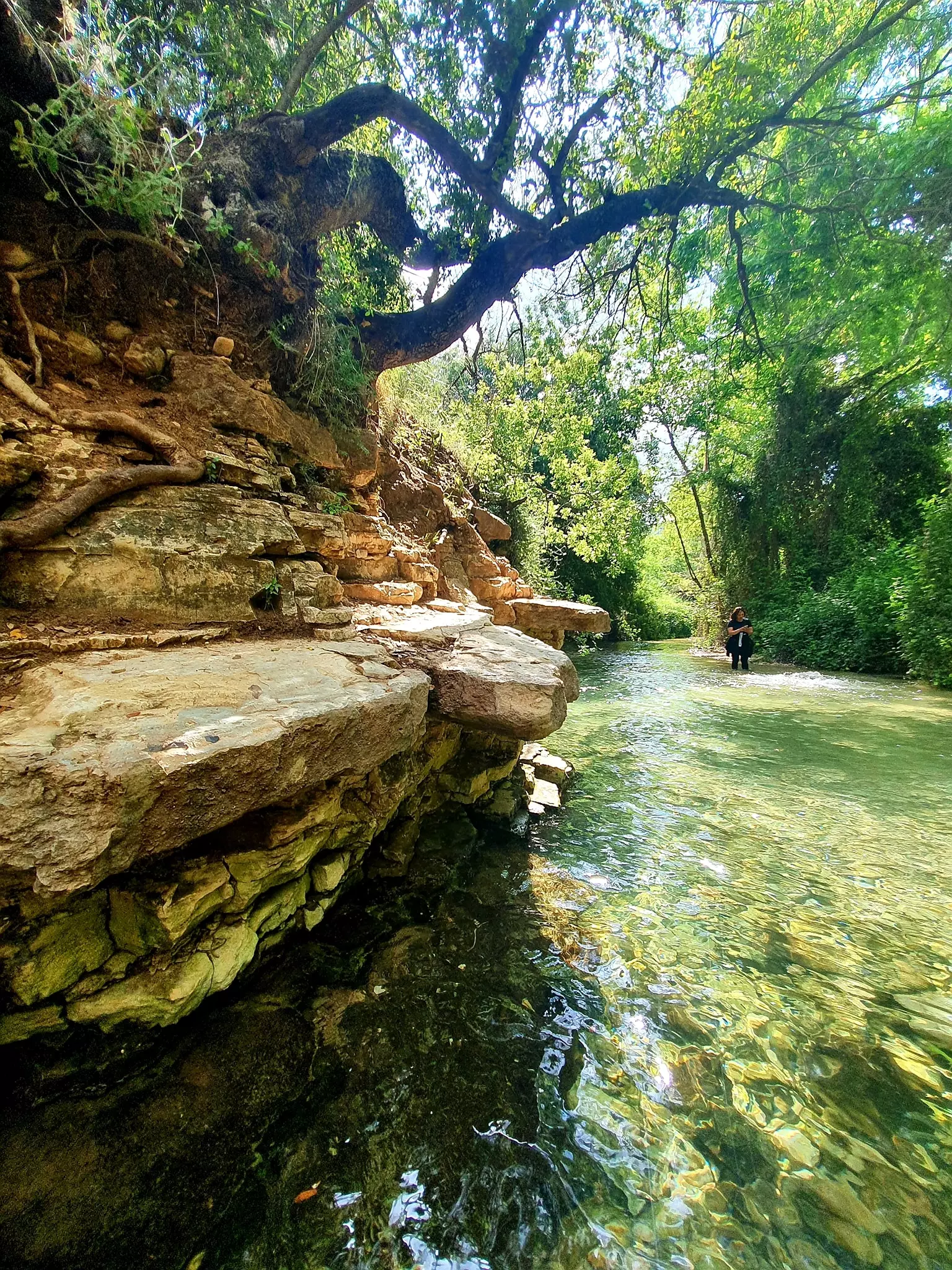
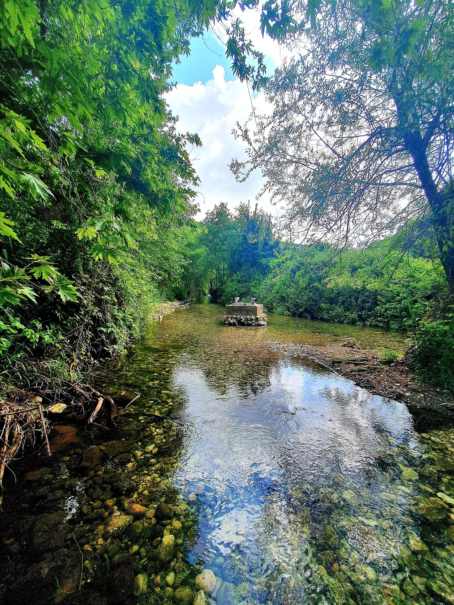
Posted by mahmoud kallam - Touring the last stages of Wadi al-Qarn & its famous mills, which ends at al-Zeeb -- May 2022 -- Nabela Salem --المقطع الأخير من وادي القرن عين الهردويل ..اراضي عرب السمنية المهجرة ...طاحونة قمح الدربسية
- Touring the last stages of Wadi al-Qarn & its famous mills, which ends at al-Zeeb -- May 2022 -- Nabela Salem --المقطع الأخير من وادي القرن عين الهردويل ..اراضي عرب السمنية المهجرة ...طاحونة قمح الدربسية #2
- Touring the last stages of Wadi al-Qarn & its famous mills, which ends at al-Zeeb -- May 2022 -- Nabela Salem --المقطع الأخير من وادي القرن عين الهردويل ..اراضي عرب السمنية المهجرة ...طاحونة قمح الدربسية #3
- Touring the last stages of Wadi al-Qarn & its famous mills, which ends at al-Zeeb -- May 2022 -- Nabela Salem --المقطع الأخير من وادي القرن عين الهردويل ..اراضي عرب السمنية المهجرة ...طاحونة قمح الدربسية #4
- Touring the last stages of Wadi al-Qarn & its famous mills, which ends at al-Zeeb -- May 2022 -- Nabela Salem --المقطع الأخير من وادي القرن عين الهردويل ..اراضي عرب السمنية المهجرة ...طاحونة قمح الدربسية #5
- Touring the last stages of Wadi al-Qarn & its famous mills, which ends at al-Zeeb -- May 2022 -- Nabela Salem --المقطع الأخير من وادي القرن عين الهردويل ..اراضي عرب السمنية المهجرة ...طاحونة قمح الدربسية #6
- Touring the last stages of Wadi al-Qarn & its famous mills, which ends at al-Zeeb -- May 2022 -- Nabela Salem --المقطع الأخير من وادي القرن عين الهردويل ..اراضي عرب السمنية المهجرة ...طاحونة قمح الدربسية #7
- Touring the last stages of Wadi al-Qarn & its famous mills, which ends at al-Zeeb -- May 2022 -- Nabela Salem --المقطع الأخير من وادي القرن عين الهردويل ..اراضي عرب السمنية المهجرة ...طاحونة قمح الدربسية #8
- Touring the last stages of Wadi al-Qarn & its famous mills, which ends at al-Zeeb -- May 2022 -- Nabela Salem --المقطع الأخير من وادي القرن عين الهردويل ..اراضي عرب السمنية المهجرة ...طاحونة قمح الدربسية #9
- Touring the last stages of Wadi al-Qarn & its famous mills, which ends at al-Zeeb -- May 2022 -- Nabela Salem --المقطع الأخير من وادي القرن عين الهردويل ..اراضي عرب السمنية المهجرة ...طاحونة قمح الدربسية #10
- Touring the last stages of Wadi al-Qarn & its famous mills, which ends at al-Zeeb -- May 2022 -- Nabela Salem --المقطع الأخير من وادي القرن عين الهردويل ..اراضي عرب السمنية المهجرة ...طاحونة قمح الدربسية #11
- Touring the last stages of Wadi al-Qarn & its famous mills, which ends at al-Zeeb -- May 2022 -- Nabela Salem --المقطع الأخير من وادي القرن عين الهردويل ..اراضي عرب السمنية المهجرة ...طاحونة قمح الدربسية #12
- Touring the last stages of Wadi al-Qarn & its famous mills, which ends at al-Zeeb -- May 2022 -- Nabela Salem --المقطع الأخير من وادي القرن عين الهردويل ..اراضي عرب السمنية المهجرة ...طاحونة قمح الدربسية #13
- Touring the last stages of Wadi al-Qarn & its famous mills, which ends at al-Zeeb -- May 2022 -- Nabela Salem --المقطع الأخير من وادي القرن عين الهردويل ..اراضي عرب السمنية المهجرة ...طاحونة قمح الدربسية #14
- Touring the last stages of Wadi al-Qarn & its famous mills, which ends at al-Zeeb -- May 2022 -- Nabela Salem --المقطع الأخير من وادي القرن عين الهردويل ..اراضي عرب السمنية المهجرة ...طاحونة قمح الدربسية #15
- Touring the last stages of Wadi al-Qarn & its famous mills, which ends at al-Zeeb -- May 2022 -- Nabela Salem --المقطع الأخير من وادي القرن عين الهردويل ..اراضي عرب السمنية المهجرة ...طاحونة قمح الدربسية #16
- Touring the last stages of Wadi al-Qarn & its famous mills, which ends at al-Zeeb -- May 2022 -- Nabela Salem --المقطع الأخير من وادي القرن عين الهردويل ..اراضي عرب السمنية المهجرة ...طاحونة قمح الدربسية #17
- Touring the last stages of Wadi al-Qarn & its famous mills, which ends at al-Zeeb -- May 2022 -- Nabela Salem --المقطع الأخير من وادي القرن عين الهردويل ..اراضي عرب السمنية المهجرة ...طاحونة قمح الدربسية #18
- Touring the last stages of Wadi al-Qarn & its famous mills, which ends at al-Zeeb -- May 2022 -- Nabela Salem --المقطع الأخير من وادي القرن عين الهردويل ..اراضي عرب السمنية المهجرة ...طاحونة قمح الدربسية #19
- Touring the last stages of Wadi al-Qarn & its famous mills, which ends at al-Zeeb -- May 2022 -- Nabela Salem --المقطع الأخير من وادي القرن عين الهردويل ..اراضي عرب السمنية المهجرة ...طاحونة قمح الدربسية #20
- Touring the last stages of Wadi al-Qarn & its famous mills, which ends at al-Zeeb -- May 2022 -- Nabela Salem --المقطع الأخير من وادي القرن عين الهردويل ..اراضي عرب السمنية المهجرة ...طاحونة قمح الدربسية #21
- Touring the last stages of Wadi al-Qarn & its famous mills, which ends at al-Zeeb -- May 2022 -- Nabela Salem --المقطع الأخير من وادي القرن عين الهردويل ..اراضي عرب السمنية المهجرة ...طاحونة قمح الدربسية #22
- Touring the last stages of Wadi al-Qarn & its famous mills, which ends at al-Zeeb -- May 2022 -- Nabela Salem --المقطع الأخير من وادي القرن عين الهردويل ..اراضي عرب السمنية المهجرة ...طاحونة قمح الدربسية #23
Want to browse more? 80,000 pictures were grouped in these gallaries:
| Display Name | Clan/Hamolah | Country of Residence |
| الخروبي | الخروبي | - |
| mahmoud kallam | عرب السمنيّة - قضاء عكا | - |
- الذاكرة مفتاح العودة-الحلقة 47- قرية عرب السمنية Duration: 23 min 22 sec
No links have been shared yet, be free to the first to share the first link.
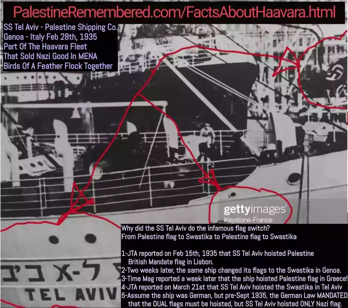 Fake Valor: Why Did Zionist Jews Hoist Nazis Flag on Their Ships in the 1930s?
What is new?
-
Facts About Oct. 7th Gaza Raid
-
Remined Us Please:: Who Did Rape Who? Palestinians Raped Israelis? Or, was the other way around?
-
When Prof. Edward Said was invited to debate Bibi Netanyahu in the 1980s, watch what happened!
-
Ezra Klein of the NY Times on the "Jewish Race".
-
Abusing Blood Libel!
-
Zionist FAQ: Isn't it true that Palestinians don't want peace? Palestinians never accepted the two-state solution
- Facts about Haavara (Transfer) Agreement between Ben-Gurion & Hitler
-
Haavara FAQs: Why Did Zionist Jews Hoist Nazis' Flags on Their Ships in the 1930s?
-
Dear ChatGPT: Gaza had a vibrant Jewish community in the mid-17th century. What happened to them?
-
Dear ChatGPT: Why did the Jewish Agency suppress news of the Holocaust during WWII?
-
Video Playlist: Jews share their DNA tests to end the conflict for good.
-
A Tale of Two Conflicts: Examining the Definition of Genocide
-
Prof. Abraham Polak And The Suppressed History of the Khazars and European Jewry
-
How Ronald Reagan would have framed the genocide in Gaza if he were still alive?
-
Haavara FAQs: Let us do the math: how many German Jews did The Haavara Agreement save?
-
Zionist FAQs: The Hebron Massacre of 1929, "clearly proves" that Palestinians are antisemitic, how could you deny it?
-
Zionist FAQs: Why Anti-Zionist Is Not Antisemitism?
-
Zionist FAQs: Isn't it true that the KGB create Palestinian Nationalism in the early 1960s?
- Zionist FAQs: Muslims are killing Muslims all the time; why are Israeli Jews being singled out in the media?
- Zionist FAQs: How is Israel an apartheid state when 20% of its citizens are Arabs who enjoy full rights?
-
Haavara FAQs: Analysis of Herzl's Uganda Scheme and how it could have saved millions of Jews.
-
Haavara FAQs: Why did Hayim Greenberg describe American Jewry as "morally bankrupt" in early 1943?
-
Haavara FAQs: What if the Evian Conference was a resounding success? What would have been the impact of saving European Jewry on Zionism?
- Haavara FAQs: What if the six million were saved, how that would have impacted the Zionist project?
-
Haavara FAQs: How did Zionist leaders react when Europe's Jews lingered in the DP camps after WWII ended?
-
Why does the American Jewish community repeat lies that David Ben-Gurion had debunked before he died?
-
Who has the power to rename the Tatar/Khazar Gene Marker to Jewish IV?
-
Zionist FAQs: Why won't Egypt, Syria, and Jordan take their people back? Jews are indigenous to Palestine, and Arabs immigrated after Jews developed the country. Arabs should leave.
-
Haavara FAQs: Did Hitler and the Nazis conflate between Judaism and Zionist? If that wasn't case, then why?
-
Haavara FAQs: Winston Churchill and antisemitism, a collection of articles written Churchill.
-
Haavara FAQs: Broken by country, how many Jews survived vs. killed during the Holocaust?
-
Haavara FAQs: Why did European Jews vote with their feet and to immigrated to the Americas, not Palestine, after WWII?
-
Watch this American Jewish Girl describing Israeli Jews' cognitive dissonance like no other in under two minutes
-
Haavara FAQs: When the Nazis went out of their way to hide the Holocaust, Israeli Jews did the exact opposite by broadcasting their genocide of Gazans. But why?
-
Haavara FAQs: How Zionist Jews went out of their to show their appreciation to Nazism and Fascism?
- Haavara FAQs: Why Zionist leaders were against bombing the death camps & the Railroads leading to them?
-
Haavara FAQs: Hitler's message to the British and American people: If Jews are such noble citizens and you care about them, how come you're not letting them in? I will gladly ship them to you at my expense, even on luxury liners!
-
A shortlist of Zionist and Israeli false flag operations in the name Jews.
-
The Most Moral Army
- The Land of Kapos (Israel): Where the brave are boycotted and Kapos walk free.
- Why did early Zionists often named their communal enterprises "colonial"?
- Zionist Relations with Nazi Germany by Faris Glubb
-
Two NY Times advertisements by Zionists in the early 1943 that exposes Zionists' treason at the height of the calamity
- Facts Not Lies about the Palestinian-Israeli Conflict.
- Site's pictures have been categorized
- Campgain Against Lice
- A Survey of Palestine, the official source about Palestine before Nakba produced by the British Mandate; over 1200 pages.
- Satellite View & Google Earth: Over 6,000 placemarks identifying all destroyed towns, W. Bank & Gaza Strip Towns, & refugee camps.
- PalestineRemembered.com and its Nakba Oral History Project were featured on al-Jazeera Satellite TV.
- Nakba Oral History Video Podcast:
 Over 700 Oral History interviews (including 3,500+ hours of recording) can be viewed online.
 - Palestine Village Statistics Project
- Gaza Jail Break
- النسخة العربية للموقع الان متوفرة
- Videos: Documenting the destroyed villages in video: Tracing all that remains since Nakba.
- Videos: Responding to Zionist Propaganda
- Interview: The ethnic cleansing of Palestine: George Galloway interviews Israeli Historian Ilan Pappe.
- For Palestinians, memory matters. It provides a blueprint for their future By George Bisharat.
- Zionist FAQ now available in Hebrew שאלות שציונים שואלים, עכשיו בעברית
- Video: The Stephen Walt and John Mearsheimer report on the influence of the Israel Lobby on U.S. Foreign Policy
- The Palestinian-Israeli conflict for beginners